|
Day: |
062 |
|
Date: |
Thursday, 3 July 1986 |
|
Start: |
|
|
Finish: |
|
|
Daily
AT Miles: |
25.4 |
|
Daily Other Miles |
0 |
|
Total
AT Miles: |
1228.4 |
|
Total All Miles |
1264.8 |
|
Weather: |
Mild, windy, sunny. |
|
Accommodation: |
|
|
Nutrition: |
Breakfast: Muesli.
Lunch: Biscuits and
peanut butter, health bar.
Dinner: Noodles and vegetables,
instant pudding. |
|
Aches: |
Feet sore, particularly 4th left toe. |
|
Animals Seen: |
Deer, squirrels, chipmunks, snake. |
|
People Seen: |
9 overnight hikers, 7 day hikers, many
others. |
|
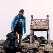
Pictures: |
Here |
|
GPS Track: |
|
|
Journal: |
Got up at 6am and managed to get away by
7:15am. Chuck gave me his address near Boston and suggested I look
him up. I set off toward Blue Mountain summit, 4 miles away, hoping
I would be able to get some water there. I only had half a bottle
and, because of the dry winter, the majority of the springs close to
the Trail were dry. There was a restaurant at Blue Mountain, but it
was closed until 11am and it was 8:30am when I arrived. There was
no outside water tap, but I found a Pepsi vending machine and
scraped together enough change to buy two cans. This is America –
no water, but Pepsi. The going had been relatively good and I was
making good time as I pressed on northward. The AT continued to
follow a low wooded ridge. Soon it became very rocky and slow again
(at least the rocks weren’t wet) and followed a rocky ridge known as
The Knife Edge. It would have been good fun without a pack on! I
continued to make surprisingly good time which I attributed to the
much lighter pack. There continued to be clear views from a number
of rocky knobs and outcrops in both directions. I reached
Overbridge Shelter at 2:30pm for a late lunch. There was a dead
(shot) copperhead snake in the fireplace. The Trail then descended
to Lehigh Gap and crossed the Lehigh River on a road bridge – there
was lots of traffic around; people knocking off early for a long
weekend. The mountains around the Gap had been denuded by pollution
from the nearby zinc smelting operation. The ascent up the other
side was steep and involved clambering over barren rocks. Good
views. At the ridge top the vegetation was still sparse. I decided
to walk until 6:30pm even though I would have passed the day’s
target (a spring). If the going was good tomorrow, I might make it
to Delaware Water Gap. At 6:30pm I found a nice little campsite by
the Trail and had a pleasant evening before retiring at 9pm. |
|
ADVENTURE LIST
Round Ireland
(2016)
Hume & Hovell Walking Track
(2013)
Via Alpina
(2012)
Australian Alps Walking
Track
(2011)
Land's End to John O'Groats
(2010)
Round Oz Bike Record Attempt
(2009)
Round Oz Bike Record Attempt
(2008)
Round Oz Bike Record Attempt
(2007)
Australia Tip to Top MTB
(2006)
Adelaide to Darwin MTB
(2005)
Sydney to Melbourne MTB
(2004)
Three Peaks Race
(2004)
Appalachian Trail
(1986)
Alpine Track
(1983)
|