Dave Byrnes' Adventures
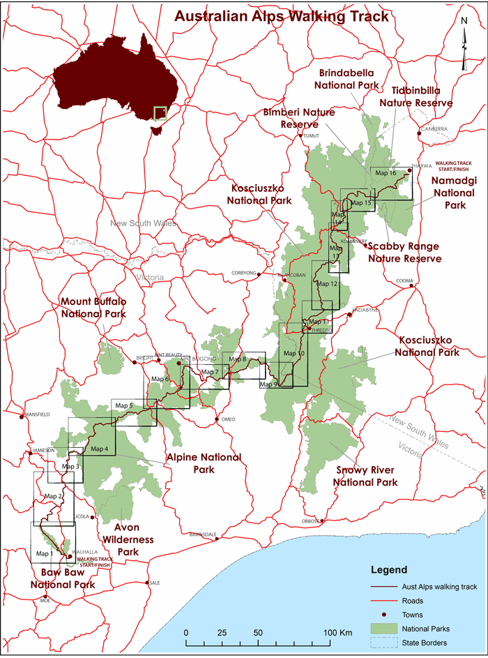
LARGER SCALE MAPS
1. Walhalla - Thomson Valley Rd 40km (PDF - 723 KB)
2. Thomson Valley - Mt Shillinglaw 50km (PDF - 698 KB)
3. Mt Shillinglaw - Mt Mc Donald 37km (PDF - 809 KB)
4. Mt McDonald - Barry Saddle 46km (PDF - 593 KB)
5. Barry Saddle - Mt Hotham 46km (PDF - 819 KB)
6. Mt Hotham - Maddisons Hut Site 47km (PDF - 838 KB)
7. Maddisons Hut Site - Mitta Mitta River 42km (PDF - 890 KB)
8. Mitta Mitta River - Buenba Hut Site 34km (PDF - 695 KB)
9. Buenba Hut Site - Cowombat Flat 46km (PDF - 627 KB)
10. Cowombat Flat - Dead Horse Gap 40km (PDF - 745 KB)
11. Dead Horse Gap - Guthega 39km (PDF - 701 KB)
12. Guthega - McKeahnies Creek 52km (PDF - 719 KB)
13. McKeahnies Creek - Kiandra 30km (PDF - 760 KB)
14. Kiandra - Murrumbidgee River 23km (PDF - 727 KB)
15. Murrumbidgee River - Murrays Gap 38km (PDF - 752 KB)
16. Murrays Gap - Namadgi Visitor Centre 40km (PDF - 418 KB)
ADVENTURE LIST
Round Ireland (2016)
Hume & Hovell Walking Track (2013)
Via Alpina (2012)
Australian Alps Walking Track(2011)
Land's End to John O'Groats (2010)
Round Oz Bike Record Attempt (2009)
Round Oz Bike Record Attempt (2008)
Round Oz Bike Record Attempt (2007)
Australia Tip to Top MTB (2006)
Adelaide to Darwin MTB (2005)
Sydney to Melbourne MTB (2004)
Three Peaks Race (2004)
Appalachian Trail (1986)
Alpine Track (1983)
You can email Dave directly at dave@davebyrnes.com.au or subscribe to his Adventure Blogs here.
You can see Dave's Running Blog here.