|
Journal: |
The early walking made up for the hard work of yesterday as I
followed the crests of Mt McDonald round to the east. Although
overcast, it was clear and I could see many kilometres to the north,
east and west. The ski village on the peak of Mt Buller across the
Howqua Valley seemed almost touchable. I remembered a year ago,
having run a race that finished at the top of Mt Buller, looking
across to these mountains knowing that was the route of the AAWT.
Despite the pleasant views, the going was slow and there was no real
track to follow. It took me far too long to eventually descend to
Nobs Track junction which I reached at noon. Aware that water was
scarce ahead, I hid my pack and walked 1.7km down a firetrail to a
pretty little creek and then hauled about 5 liters back up, having
drunk my fill from the pure little stream. By the time I had done
that and had a snack, it was after 1pm and I knew I might be pressed
to make it to Chesters Yards for the night.
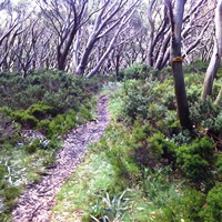
My pace improved along the firetrail, and then on the vague foot
track on the climb of High Cone (which I actually sidled across,
rather than climbed) and I started to think I might be OK for time
and enjoyed the faint trail through the snow gum forests. However,
when I decided to follow the supposed trail that crossed the slopes
of Square Top, I just could not see the track at all and ended up
wearing myself out making progress cross-country along the very
steep slippery and scrubby slope. My feet and legs became so sore
and my progress so slow, I gave up on the route and hauled myself up
the steep slope to the top where it was a relief to stand on flat
ground. I had wasted at least an hour. I still had to descend from
Square Top and then climb Mt Clear (1695m). I picked up a faint
trail on the Square Top descent. By now it was 6pm and getting foggy
and raining.
With some misgivings about the risks of proceeding at this hour
in these conditions, I pressed on, often losing the trail and saw
nothing in the fog from the top. By the time I started my descent
from Mt Clear, it was very gloomy and I slipped and fell on the wet
rocks several times but managed to stick with the faint trail. By
the time I reached the bottom, it was dark and I had to get my
headlamp out. The 3.5km to Chesters Yards in the fog and rain was no
fun on the boggy firetrail. I could barely see 5m in any direction
and worried I would miss the Yards where there was supposed to be a
place to camp and fresh water. The GPS came in handy and I arrived
at 9pm. There were cow pads about (shouldn't be cows in a National
Park, but there's a political dispute going on between the State and
Federal governments) and they had churned up the road and round the
stream. The rain fortuitously stopped, I set up camp, cooked dinner,
gave the wash a miss and was in bed by 10:30pm.
|